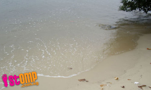
STOMPer Beachcomber hopes that something can be done to save the coast and trees of this beautiful sandy beach at in Johor. Waves pounding the shore have caused tree roots to be exposed and soil eroded.
Says this STOMPer:
"These pictures were taken at the stretch of beautiful sandy beaches between Jalan Mempurong and the Straits of Johor.
"This place is ideal for swimming, canoeing and fishing.
"This tree has its roots exposed because the soil has been eroded.
"With the waves pounding on the shore, part of the shoreline is now gone and it will be a matter of time before the tree topples over.
"I hope something can be done to save our coast and trees."

Related posts: Somebody do something to save our coastline! (16th July 2009)
Stones dislodged from damaged breakwaters are a danger to swimmers (15th July 2009)
The glory and the sad end of a giant tree (20th June 2009)
Serious soil erosion at Pasir Ris Park (14th June 2009)
More trees will be destroyed by waves hitting shoreline (5th June 2009)
Waves seriously eroding our northern shoreline at Kranji Reservoir (31st May 2009)
There's something incredibly stupid about this post.
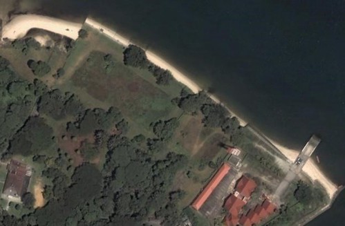
You see, based on the article submitted by this person, the stretch of coastline he is talking about is situated in the Sembawang area, just beyond the Bottle Tree Village.

Here is the area, as seen on Google Earth.
Clearly, this person is talking about a part of Singapore. So why on Earth does the opening sentence of the article refer to a 'beautiful sandy beach at in Johor'?
Was this a glaring error on the part of the editors at STOMP? Or did the person who made the original submission make a mistake? Was someone thrown off by the mere mention of the Straits of Johor?
Whatever the case, it is a very clear indicator that someone seriously needs to take a good look at a map of Singapore.